Tuesday, March 31, 2009

Touring the Historic Mormon Sites, St. George, Utah

The St. George area has many historic Mormon sites, and we spent a few hours touring and learning a bit about the history of the Mormons in St. George.

Our first stop was the Jacob Hamblin house built in 1862-63. One interesting aspect of this house was that it was built with timbers that were salvaged from Hamblin’s previous home (actually, a fort) that was destroyed in a flood in 1862. Although there was a bit of restoration, there were some items and original craftsmanship from the 1860’s, which was quite interesting to see. One thing we learned while on tour of Jacob Hamblin’s house was the origin of the phrase “Sleep tight and don’t let the bedbugs bite.” Apparently back in the 1860’s mattresses were atop a maze of ropes, and to get a firmer bed, one would tighten the ropes. The bedbugs? Well, since the pioneers stuffed their duvet covers with straw from the field, they would need to use a rolling pin to kill the bugs. Let it be known ~ Suzanne would not have made a good pioneer woman!

Next we were onto the Brigham Young winter home, where Brigham Young lived during the winters of his last years. This was a large home, also slightly restored, but also with some original items, including Young’s china which adorned the dining room table. The home was built 1869-1870, and what was even more interesting was that after Young died, no family member lived in the home – it was sold to another family, then became an office building, then owned by the State of Utah, which eventually land-swapped the home (along with the Hamblin house) with the Mormon church for some land the state wanted that was owned by the church.
The last place we toured was the Tabernacle, which was constructed in 1863-1876. It is still being used today, and was recently refurbished in 1993. The most interesting thing of architecture was that about 80% of the windows were the original ones used over a century ago.

We stopped by the Mormon Temple, but only long enough to play paparazzi and take this photo ~ having visited the Mormon Temple in Salt Lake City many years ago, we didn’t feel the desire to go again. The one thing Suzanne kept wondering, however, was how they keep the outside so white – do they wash it all the time or repaint all the time…….

One final note – the drive to Jacob Hamblin’s was quite charming – there were a number of delightful homes with large gardens along the Santa Clara drive – this alone may be worth an afternoon drive to enjoy the scenery. Oh, and all the tours were free.

Sunday, March 29, 2009

Hiking in Kolob Canyons, Zion National Park, Utah

From our location outside St. George, the Kolob Canyons area of Zion National Park is more accessible than when we will be staying in Zion (next week), so we decided to head up there, check it out, and enjoy a hike.

The Kolob Canyon area is actually higher in altitude than the rest of Zion, and is accessible by taking exit 40 form I-15. The cost to enter Zion is $25/vehicle for a week, unless, of course, you have one of the America the Beautiful passes. At Kolob Canyons there is a small Visitor’s Center and a nicely paved 5 mile road you can drive or bike. There are many turn-outs and the views were quite breathtaking. However, the reason for our travels to the Kolob Canyons area was a hike.

The Taylor Creek Hike is a 5.4 mile round-trip, 450’ elevation gain hike of easy-to-moderate difficulty (we took just under 3 hours to complete the hike). The hike begins with stairs embedded in the trail that go down, then up, then down a few times, until you’re within the walls of the canyons. The views are amazing – the orange-red walls are massive. Once in the canyon, you’ll follow Taylor Creek, zig-zagging back-and-forth over the creek 20 times at least. The creek flow wasn’t too high, and we were able to step on rocks and logs to stay dry, but as the day wore on and the sun melted more snow, the water did rise a bit for our return walk. About 1 ½ miles into the hike, there is Larson Cabin, built in the 1930’s by Gustav Larson.


About another mile into the hike is another cabin, the Fife Cabin, also built in the 1930’s for Arthur Fife.

The trail then became a bit snowy, as the canyon walls were higher, the canyon narrower, and the sun shined less in this area.


The trail ends at Double Arch Alcove, which was massive, colorful, snowy and icy. We tried, but it’s one of those things that’s difficult to capture in a photograph.


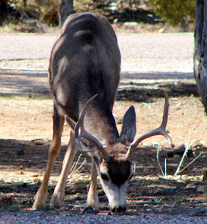
On our return (which is always faster since we stop and take most of our pictures when we are first on our hikes) we saw a couple large mule deer enjoying a mid-afternoon snack. It was interesting because we heard them walking up the hillside brush first, then spotted them. If we hadn’t heard them first, we easily could have walked right by these guys and not seem them, despite their size.

This was a great hike – a good family hike as there are lots of places to stop, and there were a lot of interesting things along the way.


Saturday, March 28, 2009

St. George Resort, St. George, Utah

We’re in Utah! Our first campground in Utah is just outside St. George, the St. George Resort, run by Western Horizons (we’re here under RPI).

Let’s start with the pros:
  • All sites are full hook-ups, including cable (which works just okay).
  • They offer WiFi, and it works!
  • There is a nice activity center with some activities.
  • Their laundry room is okay, a fairly large book exchange, and they have the typical resort amenities - horseshoes, playground, shuffleboard, mini-golf, swimming pool & spa.
  • The staff is exceptionally nice!

Now the cons, of which there is only one, but it’s a big one:

  • The sites are incredible close together! Now we lucked out with our site, because there is a guy simply parking his car on one side, and the other side has a tree, but the pull-through sites – wow – the ‘ole portrait of leaning out your window and borrowing a cup of sugar from your neighbor certainly applies here – with slides out, no joke, there is maybe a foot between rigs!

Friday, March 27, 2009

A Day of Boating on Lake Mead, Nevada

Want to see the “other” side of Hoover Dam? You know, the one from the water, the views that pedestrians walking along the dam do not see? We did, so we rented a powerboat at the Las Vegas Boat Harbor on Lake Mead, just down the road from our campground. Unfortunately, we forgot our camera, so you’ll have to believe us when we say the views were beautiful! (We were with friends who remembered their camera, so hopefully we’ll get some pictures soon.)

We were very pleased with the condition of the boat not only was everything in working order, as one would expect, but the boat was in top shape – no dirt, no trash, no torn/ripped seats – it looked new, in fact! After our tour of safety and how to drive the boat, with map in hand, we were off! Our first stop was Hoover Dam, and you can get pretty close, although due to security concerns, boats cannot get as close as they once have. It was an awesome view – on the water with the massive cement dam hovering above – definitely worth the money for the boat rental.

After enjoying lunch on the lake, we boated to various scenic areas along Lake Mead – we observed some beautiful orange rocks, sandy beaches where you can dock on the sand an swim (wait until summer, though – the water was NOT warm!), and down some beautiful channels where the rocks were beautiful white and peach colors. (Again, wish we had remembered the camera.)

We could easily have spent an entire day meandering the lake on the boat, but it was getting a bit windy and we were all cold, so after about 3 hours on the water, we headed back to the marina. This was a great time – if you have a few bucks to spare, then definitely rent one of these boats and enjoy the lake for a day – pack a lunch, some snacks, maybe some fishing gear – enjoy!!

Note – If you are not interested in captaining your own vessel, there are tour boats that will take you to Hoover Dam – check with the Visitor’s Center at the top of the hill for recommendations.

Thursday, March 26, 2009

Biking Lake Mead Railroad Tunnel Trail, Boulder City, Nevada

Our adventure for today was biking the Lake Mead Railroad Tunnel Trail, which follows the old Hoover Dam construction railroad path 3.4 miles one way through a series of five tunnels.

Years ago, to support the construction needs of Hoover Dam, a construction railroad system was built - this network of railroads provided the means to get concrete and building materials from Boulder City and Las Vegas. The tracks were dismantled in 1962 and in 1984, a segment of track, including the five tunnels, were added to the National Register of Historic Places. In 2001, the National Park Service restored tunnel 5 and reopened a segment of this historic route as a hiking and biking trail. This trail begins at a parking area just behind the Alan Bible Visitor Center, and after a quick ¼ mile path, you are on the old railroad track bed and on your way to Hoover Dam.

As you approach Tunnel 1, you get wonderful views down onto Lake Mead and the Las Vegas Bay Marina. Also, on the right side of the trail in the ravine, you will see a couple concrete plugs that were taken out of Hoover Dam for the installation of the first turbines. As you continue along this trail high above the lake, the views of the marina and the rugged rocky mountains are spectacular. Although we didn’t see any, keep your eyes open for this is an area frequented by desert bighorn sheep. Eventually, the trail works its way through the remaining 3 tunnels away from the lake and continues on the Hwy 93 side of the mountain. The last part of the trail is downhill (which means uphill heading back) and it ends at a sidewalk (near a field of transformers) which is about 50 yards from the top deck of the visitor center parking garage for Hoover Dam. The sidewalk is too narrow for bikes, so bike racks are provided (bring a lock).

From here you can walk to Hoover Dam and enjoy the views from above. While you are there, you go into the Visitors Center ($8 per person) and you can take two different guided tours (for an additional cost). In addition, there is a gift shop, sandwich shop and outdoor seating area (for picnic lunches too). There is soft serve ice cream, which we enjoyed after our picnic lunch. This trail is truly a fun and scenic way to get to Hoover Dam, while having wonderful views of the lake and the surrounding mountains.

As an added bonus, from the parking garage, you can see the new highway bridge that is being built below the dam - with the completion of this new bridge, there will be two human-made modern marvels to enjoy in one location.

Tips:

1. There are gates at the tunnel 1 and 5 that are closed at night to prevent people from using the trail. So make sure you give yourself enough time accordingly.

2. The trail area is mostly packed dirt and gravel but you can expect a few rocky areas that are loose.

3. Bring a light for the tunnels if you have trouble seeing in dimly lit areas.

4. The trail is probably wheelchair accessible, but double check if you decide to go.

Tuesday, March 24, 2009

Camping in the Lake Mead Boulder Beach Area, Boulder City, Nevada

Lake Mead RV Village
Located just inside the Lake Mead National Recreation Area on the edge of Boulder City Nevada is the Lake Mead RV Village. Lake Mead RV Village is a concessionaire of the National Parks Service. This campground offers 115 full-hookup (including cable TV) sites which includes; pull-thrus, group camping and for a few extra dollars, sites that offer unobstructed views of the lake. Even if you don't spend the extra few dollars for the lake view, most of the sites offer at least small views of the beautiful deep blue waters of Lake Mead and the surrounding red rock mountains. This campground has a general store where you can purchase a few basic supplies or a sweet snack, laundry and showers, as well as horseshoe pits and a bocce ball court. Lake Mead RV Village is an easy walk from the waters edge. The park is clean and all the sites are of average size, level and gravel with a concrete patio slab. On the perimeter of this park there are many mobile homes for the permanent residence, which honestly takes a little away from this beautiful setting.

National Park Campground
If you want to save some money yet not have full-hookups, then just adjacent to Lake Mead RV Village is a very nice treed National Park Campground. There are sites large enough to accommodate large rigs, and a tent area. The generator hours are from 8:00 am to 10:00 pm, so there is ample time to recharge your batteries. There are flush restrooms there are but no shower facilities.

If you want to stay near Hoover Dam, Boulder City, the VA, the Hacienda Hotel and Casino or just this area of the National Park, then both of these campgrounds offer good RVing options. Enjoy the beautiful sunrises!

A Lesson Learned
On another note, we learned a lesson today. At this point, we should say: "Mom, we are okay!" So after getting to the campground, we got everything set - truck unhooked, slide out, most of you know the drill ~ but we quite hungry, so just shy of putting down the stabilizer bars, we went inside and ate lunch, then got caught-up in a TV show. It was very windy the day we got here ~ 35mph winds and gusts more than that. The rig was rocking a bit, but didn't think much of it. Suddenly, the rig lurched forward about a foot and then SLAM! Things inside went for a bit of a ride, and we realized that the wind knocked us off of the pile of wood that Brad uses to place the front crank bar on (not sure of the name for this, so it will be called the "crank-thing" for this story). So, while Brad started brainstorming how we were going to raise the front end of the rig, Suzanne grabbed the camera..................enjoy!!
Here's the picture of the crank-thing in the ground (we were lucky we were on rocky soil, not concrete). Brad started to place wood under the tongue, with the idea of raising the tongue as high as it could go, placing more wood, then alternating with wood under the crank-thing.........

Brad cranking..........

We were lucky the crank-thing wasn't bent, and sand poured out as it was raised. The crank-thing was about 18" into the ground. The wood under the tongue is starting to right the rig.........

Wood then got placed under the crank-thing................


More cranking.......

Different wood under the crank-thing.....
We are now leveled............this was the amount of wood we needed to use.
As we said, a lesson learned......Brad lowered the stabilizer bars. (Side note - Suzanne actually did help.)
The end!

Monday, March 23, 2009

Katherine's Landing at Lake Mead NRA, Arizona


We explored Katherine’s Landing one afternoon not sure what to expect, but finding ourselves pleasantly surprised.

Katherine’s Landing is part of the Lake Mead National Recreation Area (NRA) on the very clear and very blue Lake Mohave, where you can camp, stay at a hotel, hike, boat, swim and more. The cost to enter Katherine’s Landing is $5/vehicle, but holders of any of the America the Beautiful Passes get in free. (It should be mentioned that we spent $80 last October for our pass, and we would have definitely paid more along the way if we paid for each place separately.)

Upon entering the Katherine’s Landing area is a marina, where many people either dock their boats permanently (including some large houseboats), or use the launch to put-in for a day (or more, I suppose). The docks were fun to meander, and we enjoyed seeing how the “water RV’ers” live! =) If you’re interested in getting out on the lake, there is a concessionaire that rents fishing boats, pontoon boats, houseboats, sea-doos, etc… There is a large campground, but with little shade in the summer, a hotel, restaurant, and small grocery. When we checked-in at the Visitor’s Center, we were told that a pack of wild burros had visited the campground the previous night! Now that’s something different than your typical deer or elk!

After enjoying the marina for a while, and seeing a school of fish which included three large stripped bass, we got in our air-conditioned car (it was hot!) and drove along the roads, enjoying the many areas at Katherine’s Landing, such as Telephone Cove, which has a lovely beach in which to swim and various other coves, many with boat launches and swimming holes.

This was definitely a nice way to spend an afternoon, and it you’re in the area, this would be a great place to set-up camp, enjoy Lake Mohave, and perhaps rent a boat, if you don’t have one already. Enjoy!

Sunday, March 22, 2009

Hiking and Viewing Petroglyphs in Grapevine Canyon, near Laughlin, Nevada

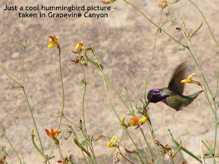
As break from the casino action, we got up early so we could hike Grapevine Canyon which is a part of the Lake Mead National Recreation Area, just minutes outside of Laughlin, Nevada. From the parking area, you take an easy flat ¼ mile hike over fine gravel to the entrance of Grapevine Canyon. Once you get close to the rocks that form the entry-way into the canyon, you will immediately notice many panels of petroglyphs on both sides of the canyon. Hiking down into the wash and past the entrance looking out, you will find even more. The many large rock panels that are easy to see are covered with a saturation of patterns. You will see typical animal, human and sun like figures but also square geometric patterns that are unique to this site. Also, make sure you look around the numerous large boulders for there you will find many patterns as well. We spent probably half-an- hour just exploring and viewing all the petroglyphs in this small area. This prehistoric site is not fenced off, so you can get intimate views of all these wonderful petroglyphs.


According to National Park Service literature, recent research indicates that some of these petroglyphs were made as recent as 150 – 200 years ago, with others dating back to over 800 years. It is believed that the Amacava people (ancestors of the modern day Mohave and perhaps Southern Paiute people) camped in this canyon for days a time and are probably creators of these rock carvings. This site made us realize how much symbols are a fundamental element of human societies not only for people a thousand years ago but still even today.


From here we decided to hike to the end of the canyon, which is about 2 miles one-way. The canyon itself is narrow with a small spring of water that supports an abundance of trees, plants, animals and patches of canyon grape vines from which the canyon got its name. The trail follows the wash of the canyon and often required us to scramble over large boulders and through narrow rock passageways. This made the hike very diverse and interesting the whole way. In the wetter areas, you’ll find yourself hiking through dense brush and plants. Throughout the hike, we had small lizards at our feet for almost every step of the way. We haven’t experience this many in all our desert hikes combined. It was fun seeing all these guys, but we got really excited when we encountered the large lizard shown in the picture below (whom we named Gary, for no reason than he needed a name). This was by far the biggest lizard we have seen in the wild. We’re not sure if he was more curious about us than we were about him.


The canyon ends at the sixth Cottonwood tree grove. Here we had another unexpected surprise and that was a large swarm of bees that had gathered near some fallen hollow logs. We heard them before we got too close, so we hiked up the side of the canyon to give them plenty of space. This canyon with its diverse terrain, interest rock formations, abundance of wildlife and of course the amazing concentration of petroglyphs, made this a MUST hike when you are in the area. If you are unable or are not interested in a hike, then at least go see the petroglyphs…you won’t be disappointed.


How to get there: Take Christmas Tree Pass Road located off Hwy 63 in Nevada at mile marker 13. Travel down a good dirt road (no problem for cars) for about two miles where you’ll see signs pointing the left. This small road leads to the parking area for Grapevine Canyon.


Saturday, March 21, 2009

Gambling at the Laughlin, Nevada Casinos


One reason we decided to stay in Bullhead City, was to go to the casinos in Laughlin, Nevada ~ we were hoping to do a little bit of gambling (and win), and since we like the tables games (craps, in particular), were hoping that the casinos in Laughlin would have lower minimums than Las Vegas. So we took the better part of the day and drove over the Colorado to Laughlin (less than a 5 minute drive from Ridgeview RV Park).


  1. There is a nice river walk along the Colorado River that connects the casinos, so we had a plan:

  2. Go into casino.

  3. Check Player’s Club promotions – if they were giving away free things, like when we went to Fantasy Springs Casino and Harrah's Ak-Chin Casino, then sign up.

  4. Check the minimum bets at the craps tables. If you do not know craps, it’s easy to have a lot of money on the table – the way we play, at a $3 minimum table, it’s easy to have $20-$30 sitting on the table – and we’re conservative craps players!


  5. Go to next casino and repeat.

So here’s the synopsis of our day:


Riverside Resort ~ has a large non-smoking area that contains a cafĂ©, shops and plenty of slot machines. The main casino area (which allows smoking) has the gaming tables and many one-armed bandits. They had a few promotions with their player’s club, some coupons for a free hot dog, discount on their bowling and such. Their craps tables had $3 minimums (we later found out that most casinos had minimums of $5), but we did not yet checked out their other table game minimums. One interesting part of the Riverside was their antique car and motorcycle collection, on the third floor and free ~ it was interesting. Also, they do have an RV Resort - full hook-ups and over 700 sites.

Aquarius ~ This was a nice hotel/casino and even though the entire casino allowed smoke, it smelled the least smoky of all the casinos – perhaps they had better air control. (Note – please do not be offended if you’re a smoker and we mention the smoky casinos.) No promotions on their player’s club, so we skipped that part of the plan, but we did eat at their Outback Steakhouse restaurant, which had very slow service, but nice lunch combos. We would have played here if the craps table minimums were lower – they were all $5 minimums.

Edgewater ~ We were here only a few minutes – no good Player’s Club promotions, very smoky, and the tables had high minimums – so off we went!

Colorado Belle ~ This is made to look like a riverboat, so it’s somewhat pretty at night. It was rather smoky, had no good promotions for their player’s club, but we did see $3 craps tables and some happy people, so we decided we had walked long enough one gentleman with a very nice stack of very colorful chips ~ he actually left shortly after we joined, and the dealers shared that he got there about an hour ago, started with $20, and left with $950.…timing is everything ……… we (Suzanne) lost $40 pretty quick!

Tropicana Express ~ This was a nice casino, not too smoky, with the best Player Club Promotion – get a free t-shirt! So, of course, we each signed-up, but since the only t-shirts were XXL, Brad got two new t-shirts, and Suzanne got none. The tables were $5 minimums, so we left, it was getting late, and we wanted to do more gambling, so………….


........back to the Riverside Casino where we went to a $3 craps table in the smoking section and in a couple hours, walked away with a profit of $115! Not too bad for a day’s take – 2 shirts for Brad, a net profit of $75, and all-in-all, a good ‘ole time!

Friday, March 20, 2009

A trip to Lake Havasu City, Arizona

What about visiting Lake Havasu City when staying in the Bullhead City, Arizona or Laughlin, Nevada areas?

The drive from Bullhead City to Lake Havasu City takes you through several small towns that line the highway and through barren desert landscape that frankly was not that interesting. The drive itself took over an hour. The only thing that is slightly attention-grabbing on the trip south was the price of gas when you cross over and travel into California for a small stretch. The gas prices in Needles, California ranged from $.80 to $1 higher than those in Arizona. It was shocking. Needless to say, make sure you fill-up before leaving Arizona.

The main attractions in Lake Havasu City are the famous London Bridge (it’s the actual bridge that once crossed the Thames Rive in London, England), the lake itself, and the spectacle of the college spring breakers now converging onto the Paradise Channel portion of the lake. Paradise Channel is a person-made channel that is lined with hotels, restaurants and shops, and forms the large island in the lake. It a nice walk, albeit it takes only about 15 minutes to walk the length. There is a grassy, shady dog park, restrooms, and nice views of the channels and Lake Havasu. The London Bridge connects this island to the city, and is easily viewable from the Paradise Channel walkway.

If you are a boater or a desert lover, then the attraction to this area is obvious, but if you are just a tourist exploring the area, then your time is better spent elsewhere. However............one positive was the resurrection of the ABC Car Game. When we're bored on a long stretch of road, we've played this game. Here's how, in case you are either ever in the car with us, or are simply bored on a drive as well. Basically, you look for stationary signs with the letters of the alphabet, and see who gets through the entire alphabet first. For example, as you're driving along and see Applebee's, you can say/scream "A in Applebee's". The other person cannot use Applebee's for A. Then it's "B in StarBucks!" and so on..... You get the idea. The Q is a tough one - look for liQuor stores, Dairy Queens, and liQuidation sales. Z can also be tough, but not in AriZona!


Thursday, March 19, 2009

Ridgeview RV Resort, Bullhead City, Arizona

Ridgeview RV Resort is a Sunrise Resort in Bullhead City, Arizona, just over the boarder from Laughlin, Nevada near the Colorado River. We are staying here under RPI and enjoy the park. It is large (over 300 sites), all with full hook-ups and cable (although ours doesn’t seem to work). The roads are paved, and each site is desert dirt/gravel, and all are back-in; there are no pull-throughs. There is free, very good WiFI available at the Activity Center, lots of activities planned each day, a decent-sized book exchange, and a pool, yet it’s not in working order these days. The one staff member with whom we spoke was very nice. The location couldn’t be better to explore the surrounding area and to (hopefully) win big at the casinos in Laughlin!

Wednesday, March 18, 2009

Going to the Grand Canyon ~ Here is Great Information!!


After spending some time in the South Rim of the Grand Canyon, we put together some information to help the future traveler to this incredible place. Just click on each link below, and you’ll be taken to the information. Feel free to email if you have any questions ~ enjoy!


Information about Hotel Accommodations
Information about Camping Accommodations
Information about the FREE shuttle
Information about Dining Options
Information about Nice Day Hikes

Only One Day to Explore? Here are some suggestions on how to maximize your time.

Desert View & The Watchtower
Tusayan Ruins and Museum

Interested in looking at photos of the Grand Canyon? Click here.

Happy Travels!

Nice Day Hikes in The Grand Canyon, South Rim, Arizona

Some Nice Day Hikes in the Grand Canyon (South Rim)

Along with walking the Rim Trail for as long as you’d like, there are a few hikes you can take into the canyon, which offers an entirely different perspective than looking down from the rim. These hikes can be as short or as long as you’d like, these are just some recaps of what we did when we visited the Grand Canyon. Please be sure you bring plenty or water and wear good shoes. A good rule of thumb to follow when canyon hiking – it takes twice as long to hike out, so if you hike down a mile and it takes you ½ hour, expect the same mile going up to take an hour.

Bright Angel Trail ~ This is a well-maintained trail with lots of visitors, including mules, so be sure you wear good shoes, as you’ll be stepping around (or possibly in) mule waste. One great thing about this hike is in about ¼ mile, just after the bridge, are some Native American petroglyphs. Click here for more information. Some nice destination if you’re up for a longer hike are: the 1 ½ mile Resthouse (3-miles round trip, elevation change 1,131 ft, 345 m); 3 Mile Resthouse (6-miles round trip, elevation change 2,112 ft; 644 m); Indian Graden (9.2 miles round-trip; elevation change: 3,060ft; 933m).

South Kaibab Trail ~ This was a nice trail to hike (read here for our detailed description), and has a nice stopping point at Ooh Aah Point at 0.9 miles, with en elevation change of 600 ft (190m) and one a but later at Cedar Ridge (1.5 miles one-way, 1,140ft/346m elevation change). This trail is also shared with mules, offers expansive views, and is less crowded than Bright Angel, as you need to take the South Kaibab shuttle to get to it.

Hermit Trail ~ This was definitely the least visited trailed we hiked (for full report, click here), and for a nice change, lacked any mules and mule waste! This is a populat trail for backpackers, so you’ll see a few day hikers, and an equal number of backcountry hikers working their way out of the canyon. It is a different perspective on this trail, and it is quite steep and rocky. Some destination points: Waldron Basin (3 miles round-trip, elevation change: 1,240ft, 380m), Santa Maria Spring (5 miles round-trip, elevation change 1,760ft, 540m), and Dripping Springs (7 miles round-trip, elevation change: 1,400ft, 430m).

Ideas for When You Only Have One Day in The Grand Canyon, Arizona

What if You Only have One Day to Explore the Grand Canyon?
Here are a few nice itineraries if you have limited time in the Grand Canyon ~

Idea #1: Take a long, leisurely walk along the rim. We spent a nice afternoon meandering along the rim (click here for details of our walk along the rim), enjoying the views, as well as the exploring each thing that came our way. One suggestion would be to park your car (if you’re just driving to the canyon for the day) at either Market Plaza or the Shrine of Ages, and take the shuttle to either Mather Point, the Yavapai Observation Station, or Village East, get out and enjoy a westerly walk along the Rim Trail for as long as you like. The Rim Trail is fully paved, so accessibility for wheelchairs, etc.. should not be a problem. Once you’re done with your walk, you can take a shuttle back to your car.

Idea #2: If you’re not in the mood to walk, or the weather is not cooperating, park at one of the parking lots near Bright Angel Lodge, and grab the Hermits Rest Route shuttle getting gout at various stops along the way. This is where you can see the Colorado River, as well as some enormous, incredible, awe-inspiring views of the Grand Canyon.

Idea #3: Take a short hike into the canyon. Even if you go only ½ mile, to be below the rim is an incredible experience. Be sure you bring water, and keep track of time since it is easier to go down than up. Plan on the return taking twice as long as the descent. For ideas about hikes, click here.

Using the Shuttles at the Grand Canyon, South Rim, Arizona

Grand Canyon (South Rim) Shuttle Information


There are three FREE shuttles in the Grand Canyon, so you can leave your car & enjoy the incredible views. The shuttles begin their routes ½ hour before sunrise, run every 15-minutes, and stop running ½ hour after sunrise. We were quite pleased with the cleanliness of the buses, the ease at which to find the bus stops, how quickly we got to our destination, and the information shared by the drivers as we rode. Each bus is handicapped accessible for wheelchairs, and has bike racks in case you bike part of the way. Each is described here:

Village Route ~ This is the route that takes you around Canyon Village. There are stops at: Mather Campground -> Trailer Village -> Market Plaza (food store, PO, bank – located here) -> Canyon View Information Plaza (also where you can transfer to the Kaibab Trail Route) -> Yavapai Observation Station -> Shrine of Ages (place where evening ranger programs occur in the cooler months -> Train Depot -> Bright Angel Lodge -> Hermits Rest Route transfer -> Maswik Lodge -> Backcountry Information Center -> Center Road -> Village East -> and back to Mather Campground.

Hermit’s Rest Route ~ The shuttle is the only transportation allowed on this route, so if you head in this direction (which you should – there are some great views), this is the route to take. (Tip – Sit on the right side of the bus when heading west, you’ll get all the views.) You pick-up the Hermit’s Rest Route at the west end of Canyon Village, and you can take a Village Route shuttle to get there. There are nine stops on the way west, but only three on the return, so you should get out when you want heading westbound. The stops are: Tailview Overlook -> Maricopa Point -> Powell Point -> Hopi Point (a great sunset place, get there ½ hour before sunset) ->Mohave Point -> The Abyss -> Monument Creek Vista -> Pima Point -> Hermit’s Rest (where there’s a small gift shop/bookstore). The return trip will take 30 minutes if you do not get out and sight-see on the way back.

Kaibab Trail Route ~ This is a short shuttle bus that is mainly used by people hiking the South Kaibab Trail, since there is no parking at the trailhead. The route begins at the Canyon View Information Station ->South Kaibab Trailhead (to read about our hike on the South Kaibab, click here) -> Yaki Point -> Pipe Creek Vista -> Canyon View Information Station.

Camping Accommodations in the Grand Canyon, South Rim, Arizona

Grand Canyon (South Rim) Camping Information


Trailer Village (run by Xanterra) ~ These have full hook-ups, including cable and are all pull-through sites. We enjoyed our stay here. To read a more extensive review – click here. Price: $32/night. Can reserve by either: http://www.xanterra.com/ or call: 928-638-2631 (can call this number for same-day reservations as well).

Mather Campground ~ This is run by the National Park Service. There are no hook-ups, but plenty of sites that could house a larger rig, some pull-through. Firepits and picnic tables at every site, and it is well treed for those hot summer days. We would have stayed here if it wasn’t so cold at night and we wanted hook-ups to run our electric heater. There is a dump/sani-station, as well as showers and laundry (both coin operated). Price: $18/night. Can reserve through http://www.recreation.gov/ or call: 877-444-6777. Some sites are first-come/first-served.

Desert View Campground ~ Also run by the National Park Service, this is a self-register, first-come/first-served campground open only seasonally, usually opening in mid-May. Price: $12/night. This is located at Desert View, which is 25 miles east of Grand Canyon Village.

**Please note that these prices may change. Please call ahead to confirm rates.**

Hotel Accommodation Options at the Grand Canyon, South Rim, Arizona

Grand Canyon (South Rim) Hotel Information


El Tovar Hotel ~ Located on the rim, this is an historic hotel. Prices range from $166 (standard double bed room) to $400+ for a suite.

Bright Angel Lodge & Cabins ~ This is more rustic and also centrally located at Canyon Village. Prices range from $86 (standard room) to $160+ for a cabin.

Thunderbird & Kachina Lodges ~ These are contemporary lodges on the canyon rim. Prices range from mid-$160’s (park-side) to $170+ for canyon-side.

Maswik Lodge ~ There are rustic accommodations or if you prefer, more contemporary accommodations, This is not located on the rim, but a short walk will get you to Canyon Village. Prices range from mid-$80’s to $170’s.

Yavapai Lodge ~ Located minutes from the rim between Yavapai Point and the El Tovar, among pine and juniper trees, it is a short walk to the rim. Prices range from $100-$150+.

**Note – these are 2009 rates, please check with Xanterra for updated prices.**

Dining Options at the Grand Canyon, South Rim, Arizona

Grand Canyon (South Rim) Dining Information


El Tovar Dining Room ~ In the historic El Tovar Hotel, this is gourmet dining in a casual atmosphere – no shirt/tie required. The good is regional and contemporary. Dinner reservations suggested.

  • Breakfast: 6:30am – 11:00am

  • Lunch: 11:30am – 2:00pm

  • Dinner: 5:00pm – 10:00pm

El Tovar Lounge ~ Located near the Dining Room, this is where you can enjoy a beverage and a light snack.

  • Open 11:00am – 11:00pm.


The Arizona Room ~ Located at Bright Angels Lodge, this is your “meat-and-potatoes” place – BBQ, steaks, fish – all with southwest flavors. No reservations accepted.


  • Dinner only: 4:30pm – 10:00pm


Bright Angel Restaurant ~ Located in the Bright Angel Lodge, this is family dining with a diverse menu. This is a casual place, and no reservations accepted.


  • Breakfast: 6:30am – 10:45am

  • Lunch/Dinner: 11:00am – 10:00pm

Bright Angel Restaurant also has a small bar adjacent to the main dining, open from 11:00am – 11:00pm, with a small menu and full bar.

Maswick Cafeteria ~ Served cafeteria-style, it offers six food stations, such as pasta, burgers, hot sandwiches, Mexican, etc… Open 6:00am – 10:00pm. There is a Sports Bar as well where you can shoot some pool and enjoy a cold beer.

  • Open 5:00pm – 11:00pm.

Canyon Café ~ Located at the Yavapai Lodge, this si only opened seasonally and offers home-style selections such as fresh baked pizza, fried chicken, hamburgers, and a salad bar. Check at the front desk to see if open when you arrive.

Tuesday, March 17, 2009

Hiking along the Hermit Trail, Grand Canyon, Arizona


Today we wanted to explore a different part of the Grand Canyon, hike a trail for around 3 miles round trip, and have no mules and fewer people, so we decided on Hermit Trail. To get to this trail you must take the Red shuttle bus to Hermit Rest on the west side of the park. The trail begins about ¼ mile past the Hermit Rest gift shop along the rim. The hike begins down a small ravine that leads to a large side canyon that feeds directly into the main Canyon.

The trail is immediately steep and difficult to negotiate since you are hiking over large stones and loose rocks. Following the switchbacks, we worked our way down the east side of this side canyon and in the opposite direction of the main canyon. It isn’t until we hiked around .5 miles, that we began to get views of the main Canyon at the opening of this side canyon. The trail continued to wind further down and back into this smaller canyon, quickly losing views of the Grand Canyon, yet there are wonderful views of the dark read canyon walls that make up the opposite "wall" of this smaller canyon. Quite honestly, although it was interesting views, without views of the National Park’s star attraction, we started to quickly lose interest in this hike, but continued for a bit, with hopes that the vantage point would improve.

Unfortunately the main canyon views didn’t improve within the distance that we wanted to hike, so we turned around and headed back about .5 miles short of the Waldon Trail junction making our hike a little less than 3 miles roundtrip, with an elevation change of 1,100 feet. This hike took us one hour down and 1.25 hours back out. You would have to hike another 1-2 miles past our turn around point to start getting views of the Grand Canyon. We would not recommend this hike for views of the main canyon, unless you are interested in a long day hike. The best views of the Grand Canyon in this part of the park are from the rim at Hermit's Rest...and that’s a must see!

Monday, March 16, 2009

Enjoying the South Rim Trail, Grand Canyon, Arizona

It ended up being a nicer day weather-wise than we anticipated, so we took one of the free shuttles to the Yavapai Observation Station and walked the rim westbound, enjoying the expansive views, various lookouts, and a ranger program.

Yavapai Observation Station is 1 ¾ miles east of the Village, and has exhibits focusing on the geology of the Grand Canyon, including three-dimensional displays, photographs, and exhibits. One display in particular that caught our attention was how the canyon was formed. There is a also a bookstore and a variety of Ranger programs offered at various times. You can also see the Kaibab bridge over the Colorado River linking the North Kaibab Trail from the North Rim to the South Kaibab Trail in the South Rim.
After walking about 1 ½ miles enjoy the views from the rim, we came upon the Verkamp’s Visitors Center, which used to be a privately owned store, but is now a NPS visitor station. We stayed and enjoyed a Ranger program called The Human Story, about how people shaped the history of the Grand Canyon, from the pre-historic Puebloan people to the railroad to the current visitor.

The Hopi House (a Mary Colter building) was our next stop where we happened upon Navajo men giving a performance of dancing and chanting, sharing the history of the dances, the traditions of the Navajo, and giving people the opportunity to appreciate the Navajo culture.

As always, we were hungry by this point, so we stopped at Bright Angel Lodge to have lunch at their Restaurant. Both the service and food were good, but not great. We then quickly stopped at Lookout Studios (another Mary Colter building), which was basically a gift shop and bookstore, but were pleasantly surprised by Kolb Studio, once the home of the Kolb Brothers who were the original photographs of people on mules, back in the day. Not only was the home quaint and charming, but the downstairs is a gallery with free art exhibits, and while we were there, it was showing art by the students who attend school at the Grand Canyon School District! We were amazed at the talent ~ from the kindergarteners to the high schoolers.

We then took a short detour just ¼ mile down the Bright Angel Trail to just past the tunnel. Why? Well, at the Ranger program earlier in the day, we were told that there were some pictographs in the rocks just past the tunnel ~ Too cool! So just past the tunnel, about 20 paces, look up and left – there is some very amazing art.

The Rim Trail is paved and accessible – even if you do not have the time or the inclination to walk many miles, just getting out and enjoying some of the views is a great experience – a definite “must do” when in the south rim of the Grand Canyon.

Sunday, March 15, 2009

Tusayan Ruins and Museum, Grand Canyon, Arizona

On our way back from Desert View and The Watchtower, we stopped at the Tusayan Ruins and Museum (free admission). The Tusayan Ruins were once a community of 30-50 people, with a farm area, kiva, family areas and community areas. There is a short dirt path that winds around the ruins, of which although here has been some stabilization, there has been no reconstruction. The museum has authentic items dating back 2,000 – 4,000 years and has some pottery, arrowheads, and jewelry, all found in the Grand Canyon. One of the most exciting items on display is an original split-twig figurine - a single-twig shaped into an animal shape. The path is wheelchair accessible and there is a Ranger program offered twice daily (11:00am & 1:30pm) called “Glimpses of the Past” that shares the story of how the Puebloan community thrived in such a harsh climate.

Driving back from visiting Desert View and the Tusayan Ruins, we stopped at all of the overlooks along the way, since now they were on the right side of the road. Navajo Point and Lipan Point offer panoramic views of the eastern side of the canyon, while Moran Point and Grandview Point give the opportunity to see larger views of the canyon as we drove closer to Grand Canyon Village.

Saturday, March 14, 2009

Exploring Desert View & The Watchtower, Grand Canyon, Arizona

About a 30 minute drive east from centrally-located Grand Canyon Village is the area knows as Desert View, which is where not only can you see the spectacular “beginning” views of the eastern side of the Grand Canyon, you can also see the Painted Desert as well as the famous Watchtower.

After enjoying and appreciating the different views the east side has to offer, we entered the Watchtower, which was designed by architect Mary Colter (who also designed Hopi House, Phantom Ranch, Hermit's Rest, to name a few). The outside structure of the Watchtower is stone, and meant to mimic the Pre-historic Puebloian people’s towers (formerly know as Anastazi, as we learned at a Ranger talk) and is five stories tall.

Once inside the tower (which you can get to via the NPS gift store), there are stairs (thus not wheelchair accessible) to the very top. As we climbed the stairs, the tower slowly got a bit smaller in circumference. Each level was open in the center, thus allowing a view of the colorful ceiling - the walls were adorned with reproductions of petroglyphs and pictographs – and windows on every level allowed for magnificent views.

Also at Desert View you’ll find a bookstore, information center, restrooms, a small dining/grocery area, a gas station and a seasonal (mid-May opening) campground.

This is a great way to spend a few hours, even if you aren’t able to climb in the Watchtower, since the views are different than what you can see from the Village, and to see the level land of the Painted Desert just “drop-off” and see the edge of the Grand Canyon – that in itself was fascinating.

Friday, March 13, 2009

Hiking the South Kaibab Trail, Grand Canyon, Arizona

To get a real sense of the magnitude of the Grand Canyon and to get views from within, we hiked down the South Kaibab trail to Cedar Point. This trail is the only person-made trail in the park and begins just southwest of Yaki Point. The trail immediately descends through a series of tight steep switchbacks that were cut through the side of sheer rock cliffs.


Once through this area, the trail levels a bit and continues without switchbacks following along the contour of the ridge. From this area looking to the left under the rim, you will see the first of several micro-climate zones. This zone is a small forest of Douglas fir trees which seem truly out of place in this desert landscape. These trees only exist under the shadow of the rim where it’s much cooler and has more moisture than the surrounding areas. Continuing on the trail, as you start getting closer to Ooh Aah and Cedar Points, the trail becomes a series of large steps created by timbers laid across the trail. These steps are hard to hike down (or up), for the mule and hiker traffic over the years has made the steps very deep so you have to take long unnatural strides to transverse.

Ooh Aah Point is the first viewpoint that you come to where you can see down the Grand Canyon to the east. This viewpoint is 0.9 miles from the top with a descent of 600 feet. From here you are a little more than halfway to Cedar Point. This is a great place to take in the enormity of the canyon and gain a perspective on how large the Inner Canyon really is, in comparison with the entire Grand Canyon (two huge canyons in one). Pushing on a little further, you reach Cedar Point which is a small plateau. This is a wonderful place to get expansive views down the canyon in both directions (east and west). Here you can really see the canyon open up. Cedar Point is 1.5 miles from the top with a descent of 1140 feet. This is a great place to have lunch, take some incredible photos and use the pit toilets before you hike back or continue down into the canyon.

While we were resting and exploring at Cedar Point, a team of pack-mules packing out trash from Phantom Ranch (which is at the bottom of the canyon) stopped for a needed rest. They invoked a nostalgic feeling of the canyon’s historical past and although these mules are hard on the trails and leave their waste, they are still necessary today to provide access to the canyon that would not be possible otherwise.

This hike took us 1 hour and 45 minutes round trip, not counting the hour we spend at Cedar Point. From the rim to Cedar Point you pass through 10 million years of geologic history and for each step you go back in time 2000 years so take your time and enjoy this wonderful hike and experience.

Tips:

1. Bring plenty of water and wear proper supportive hiking shoes.

2. When going up, walk on the sides of the trail or even on the inside bordering rocks for it’s much more level. You won’t need to take such big steps thus making it much easier.

3. Make sure you stop and look at the canyon at various times along your hike. We found the lighting was always changing, thus significantly changing the colors and shadows of the canyon.

4. You can’t drive and park at this trailhead. You must take the free shuttle bus from the Canyon View Information Plaza.

Thursday, March 12, 2009

Full Moon Walking in the Grand Canyon, Arizona


Is it safe to walk along the rim of the Grand Canyon at night? It is if there’s a full moon out lighting your way. We went on the Full Moon Walk and Star Talk with a NPS (National Park Service) Ranger, and about 200 other people.

As the moon rose over the Grand Canyon, we assembled at Mather Point and began our walk heading east towards Pipe Creek Vista. Along the walk, the Ranger shared how the Navajo people believe they came from the Grand Canyon and unless given special permission, do not enter the Grand Canyon on foot again, since that is where their spirit returns upon death. We also learned that the Hopi believe that the moon and the sun were made from rose quartz and were taken to the ski by two tribe elders who sacrificed their lives for their people.

As the walk continued, we looked into the (not so dark because of the full moon) sky and saw Orion’s Belt, Venus, Polaris (the North Star), the Big Dipper, and more. As the walk neared its end, we even saw a herd of elk grabbing a late dinner.

This was a great (albeit cold) walk, and if you have the chance to be in the South Rim of the Grand Canyon during the full moon, definitely grab your camera and take this walk!

Wednesday, March 11, 2009

Camping at Trailer Village, Grand Canyon, Arizona

When we decided to come to the Grand Canyon (South Rim) a couple months ago, we debated whether to boondock (camp without hook-ups, for those non-RV’ers out there) or go to Trailer Village where we could get full hook-ups. Well, as you can see by the title, we chose full hook-ups and we are thrilled we did, since we woke to 14-degrees this morning ~ brrrrrrr!!!! (We are enjoying our electric heater immensely!!)

Trailer Village is run by Xanterra, a private concessionaire. It is only ½ mile from the rim of the Grand Canyon, is on the shuttle route (the National Park Service has free shuttles to get form place to place) and has over 50 full hook-up sites, including cable (much to Brad’s delight). All sites are pull-though, there are restrooms, and recycling. There is no WiFi, but the National Park Service has WiFI at it’s administrative offices and library. When we checked-in, the staff was very nice, and the entire “village” is well-kept and clean. There are a few trees, and while we ate lunch, three deer meandered by while grazing the new grass.

Tuesday, March 10, 2009

Shopping Opportunities in Sedona, Arizona

The town of Sedona has a lot of interesting shopping opportunities ~ we meandered around the streets one day, enjoying the unique shops (such as Buck Thornton’s World of Jerky), the many t-shirt shops where t-shirts are colored using the Sedona dirt (Brad got one), lots of restaurants (see yesterday’s post), beautiful art galleries, the typical touristy shops (we did get Alien ID cards), and more. Although there are a lot of smaller areas in which to shop, you can walk along the Main Street in “Uptown” (89A) as well as a higher-end Tlaquepague Arts & Crafts Village (pictured) downtown, which houses more art galleries, unique gift shops and restaurants.

We posted all of our Sedona (including more petroglyph pictures from V-Bar-V Heritage Site) ~ click here & enjoy!


Monday, March 9, 2009

Lots of Restaurants in the Sedona area, Arizona

We enjoyed many restaurants while enjoying Sedona and the surrounding area, so here is our report on all our good eats ~

The Hideaway Restaurant ~ We already wrote about our experience at The Hideaway restaurant (click here), and given that we’ve eaten at a lot of other places, we’ve decided that this isn’t really worth the time, unless you want to enjoy the great views. Equally good, if not better, food can be found elsewhere.

Cowboy Club ~ We enjoyed a late, light dinner here one evening and actually both ordered their tortilla soup, which was excellent and accompanied by some wonderful hot-from-the oven bread. It is difficult to judge the entire menu on just their soup and bread, but if the rest is as good, then this is the place to go when you’re in Sedona. The service was excellent as well.

Wildflower Bread Company ~ We ate here twice – once for lunch (read our lunch review here) and another time for breakfast – we still think this is a great, reasonably priced place for great soups, sandwiches, and yummy desserts. It is located in the middle of town and would be a great place to stop for lunch during a day of shopping in Sedona.

Bun Huggers (in Flagstaff) ~ We couldn’t resist this restaurant simply because of the name – and we’re not 100% sure, but it must be by a local university since we were the oldest ones there by quite a bit, but it was a good place to pick-up some good hamburgers that are reasonably priced. One thing Suzanne especially liked was that you could order small (1/4 pound) and regular (1/2 pound) sized hamburgers, since large burgers are often too much for her to eat in one sitting. There is no service here - you order, sit, wait to be called, then go get your food and pay. There is also a condiment bar where you dress your burgers (or hot dogs, or whatever you get) yourself. Wouldn’t necessarily go back, but it was a fun stop.

The Palace - Haunted Hamburger (in Jerome) ~ We were told by some of our blog followers that this was the place to get lunch in Jerome, and since we listen to our followers, off we went! One word – BUSY!! We were there at an “off” time – about 3:30 in the afternoon and it was packed. It stayed packed the entire time, but we must say that it added to the ambiance of the place. Their menu is much more extensive than only hamburgers, but since they are famous for their burgers, that’s what we ordered. They were large, good burgers, although no matter how you ordered (one person at our table ordered medium-rare and we ordered well done), they all seemed to be cooked the same. The fries were great and we were absolutely stuffed by the time we left. If you’re a burger-loving person and in Jerome, this is the place to eat. Is it haunted? Perhaps……

The Grapes (in Jerome) ~ We visited The Grapes when we were in Jerome (reviewed here) and would still recommend it if you are looking for an upscale place in Jerome, especially one that list specific wines to complement a meal.

Rincon Del Restaurante Mexicano ~ We had a late dinner here and didn’t necessarily love the food or the service, and we wouldn’t recommend eating here given the many options for Mexican food in the Sedona area. The food was okay and the service also just okay; the only redeeming quality was the novel atmosphere of sitting outside under blankets keeping warm while we ate – that was an amusing experience.

Picazzo’s Gourmet Pizza ~ The pizzas were great (Suzanne enjoyed a unique pesto marguerite pizza), the service very good, and we enjoyed a very garlicky Caesar salad, the only downside was that this was an expensive place for pizza. If you go, you might want to try for lunch instead of dinner, as the lunch menu was more reasonably priced.

Concho’s Mexican Restaurant (in Cottonwood) ~ We also already reviewed this restaurant (click here), and since having Mexican food at other places in the area, this is high on our list, although we wouldn’t make a trip to Cottonwood just to eat here. If you’re in the Cottonwood area and in the mood for some good, authentic Mexican food, this is the place for you.

Sunday, March 8, 2009

The V-Bar-V Heritage Site, near Sedona, Arizona

The V-Bar-V Heritage Site is an amazing collection of petroglyphs done by the Sinagua people over a thousand years ago. If you do not know, a petroglyph is, it is a symbol etched into desert varnish (the blackened area), and have been found all over the world. Interestingly enough – some of the same symbols that are found in north America have also been found in Australia – how that happened is still a mystery.

It is thought that the petroglyph site at V-Bar-V was a sacred area where shamans prayed and the people visited for spiritual rituals, such as fertility or rain. The petroglyphs at V-Bar-V number over 1,000! Among the individual symbols, there was even a calendar devoted to agriculture – for example, at the Spring equinox, the sun shines through two “shade rocks” and the beam is directly pointed to a “sun” petroglyph, which meant it was time to plant the crops. Other times of the year that the agricultural calendar came into play were the summer solstice, Autumn equinox, winter solstice, and the start of the monsoon (rainy) season.

One of the amazing characteristics of the petroglyphs at the V-Bar-V Heritage Site is the great condition of the petroglyphs – as this area was part of a private ranch for over 100 years, the wall was protected from the public and there is no graffiti and minimal damage to the wall. In fact, the owners of the ranch knew what a sacred area this was, so they fenced it off from their cattle, and the only damage is a few bullet holes from some rowdy cowboys. (Yup – that’s true!)

If you like petroglyphs, then this is a must-see for anyone in this area. You’ll need a Red Rock Pass ($5 per day; $15 per week -available for purchase at the small gift store, which remember, is free if you have one of the America the Beautiful Passes) and it’s off I-17 and Scenic Road 179 on Forest Road 618, just paste the Beaver Creek Campground. Once you park your car, you need to walk down a well-maintained dirt path to the visitors center, check-in, and then walk the ½ mile dirt trail to the site, where a Forest Service Volunteer is able to answer your questions and share the history of the site. The path is do-able on crutches, but as far as wheel-chair accessible, it is flat and a bit rocky, well-worn, but you might want to call to see if they recommend wheelchairs.


**We'll post more photos of the petroglyphs in the next few days...........stay tuned!!**

Saturday, March 7, 2009

Touring Oak Creek Canyon, Sedona and more…, Arizona

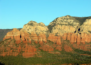
Today we set out to explore the sights in Oak Creek Canyon and Chapel Hill in Sedona. To begin our day of adventures we drove from Sedona north on Hwy 89A straight through until we reached the vista area at the vary top of the canyon. Here you can get some great photos looking down into this canyon from various viewpoints on the rim. It was quite interesting to see the terrain change so quickly from the bare red rocks and desert Cyprus trees around Sedona to ponderosa pine forest covered mountains and patches of snow at the top. At this vista is a small gift shop and many Native American’s selling their jewelry, pottery and more. From here we started back down (south) the Oak Creek Canyon towards Sedona with the goal of stopping at the many sights along the way. The highway at the bottom of the canyon follows along the creek. Here the forest changes again to groves of Arizona Sycamores and black oaks that line the valley floor. There are some wonderful views of the creek tumbling through large rocks and of bare rock formations that are starting to appear.

Moving further south we stopped at Slide Rock State Park. This is a popular park for swimming in the summer time that is right off the highway. Originally, this site was an apple orchard homestead but because the creek here forms slow moving pools with wide level rocks shores, it’s become a popular place to escape from Arizona’s hot summer temperatures. Being off-season, we were able to get great photos of the beautifully colored rocks that line the creek here. High above this state park, you begin to see more of the bare red rock formations that are like what you see throughout the Sedona area. It was interesting to note the landscape changes as you progress through the canyon.

As you know sightseeing makes us hungry (probably from lifting the camera so often), so per a recommendation we tried the Wildflower Bread Company that’s located in the The Shops at Pinon Point Shopping Center which is part of the Hyatt Hotel. Here we found large wonderful sandwiches made with homemade breads, terrific soups and yummy desserts. Brad couldn’t resist the light and flaky cinnamon roll smothered with white frosting. This is a moderately priced restaurant, with high quality food, wonderful service and amazing views off their back patio.

Stomachs full, our adventure continued…………..

Chapel of the Holy Cross
This is a small catholic chapel built in 1957 to the design of Marguerite Brunswig Staude who was a student of the world-renown architect Frank Lloyd Wright. The unique but simple concrete structure built between two large rocks rises 200 feet above the ground and supports a large 90 foot wide cross. This location offers not only up close views of the red rocks to the back of the chapel, but also incredible panoramic views of many surrounding formations. The Chapel is open Monday through Saturday from 9:00 AM to 5:00 PM and on Sunday from 10:00 AM to 5:00 PM. In the basement of the chapel is a small gift shop that offers a variety of religious items.
Parking is along the spiraling road that leads to the chapel with handicap parking at the top. There is then a spiraling path which is wheel chair accessible that takes you the remaining 100 feet to the chapel. This Sedona landmark is a must see and free, so….enjoy the views!

Conchos Mexican Restaurant
Later in the day we found ourselves back in the town of Cottonwood. Per another recommendation we went to Concho’s Mexican Restaurant in Old Town Cottonwood for dinner. This is a family owned and operated restaurant that offers a large variety of high quality Mexican food. Our waitress was a lot of fun, provided great service and was very helpful in recommending food and drinks on the menu. As a bonus we saw the local peacock flying from the roof tops of the nearby buildings. This restaurant is located as you are leaving the old town area towards Jerome. If you are in the area and have a hankering for Mexican food in a welcoming atmosphere, then this is the place for you.

Blog Archive