We set the alarm for 6:30am today and had the same breakfast
as yesterday. As we mentioned before, we took the bus to Le Tour for the first leg of
our hike. (Side note – the hotels in Chamonix give free bus passes.) It was the
first time we’ve hiked with a baguette sticking out of the side of Brad’s pack!
We took the 8:42am bus to Le Tour and arrived at 9:10am. There was an option to take the gondola up and
save a couple hours, but we were ready to start hiking and so we did – pretty much
under the ski lifts, but it was still nice and a good way to start our
adventure. It should be noted, however, that we live at about 300ft elevation
(100 meters) and we were definitely feeling the altitude as we started hiking - Le Tour is at 1,453 meters (4,767 ft) and we
hiked up to 2,204 meters (7,231) that day, then back down to 1,527 meters
(5,010 ft).
There were some really nice views quite quickly as we made our way to the Col de Balme, which took us two hours. Interestingly, the signs in Switzerland have times, rather than kilometers, from one point to the next. We thought this was kind of strange since people walk/hike at different speeds - stop for more/less time, etc.... This was the only time on the entire hike we hiked in the time the signs stated - generally we were slower. (We did meet a foursome from Colorado who took the times very seriously - they were often checking their pace. Seems a bit stressful if ya ask me....)
The Col de Balme is at the border of France and Switzerland - and here was the "monument" declaring such. (It was less than knee high and one could easily just walk right past it and not notice it.)
Last view of Mont Blanc!!
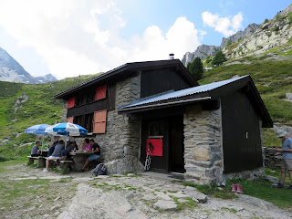
There is a chalet-refuge at Col de Balme - it was super cute and tons of people were sitting around having a snack. There is a restaurant as well as half-board (breakfast and dinner) option for guests.
Some views from the Col.......
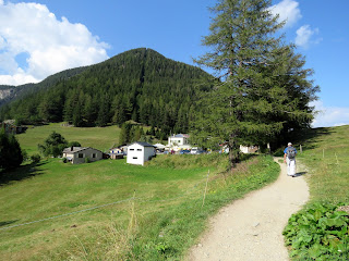
This is the town of Le Tour, where we started. Shit we're high!
We continued towards Les Grands with some amazing views, however it was a tough hike, and we definitely did not make "sign time" - it was about three hours of us hiking at a moderate pace. It was quite steep in sections - over huge rocks. Many times Suzanne had to go on her rear to get down to the next rock, as the "step" was way too deep. We definitely felt every small, medium, and large rock as we hiked this steep section . We passed one hiker coming from the opposite direction who used the word "trepidous," which was spot-on. (Although perhaps not a real word....)
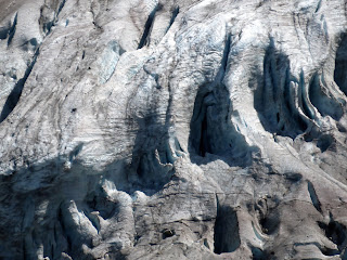
Eventually we had views of the Glacier du Trient - where Suzanne took many pictures.
(This may be one of the reasons we never "made time.")
There were also views of the smaller Glacier des Grands - with the Refuge Les Grands finally visible.
Finally, three hours after the Chalet-Refuge Col de Balme, we arrived at Refuge Les Grands (2,113 meters; 6,932 ft) - another place where people can stay, but they have to bring and prepare their own food.The trail was up-down-up-down-up-down over huge rocks, so although the elevation gain/loss wasn't much, it was still slow-going.
We enjoyed our "provisions" for a quick 15-minute lunch, and continued onto our next destination - Chalet du Glacier.
Along the way we had views of another refuge - Relais d'Arpette
And spent the next hour-and-half hiking a 2,000 ft decline for 1.5 miles.
(Yup - our quads were feelin' it!)
Eventually we could see the Chalet du Glacier in the distance. We continued to have amazing views of the Glacier du Trient - in fact, today's route took us below it and tomorrow's route will take us up on the opposite side from today.
We crossed a bridge that spanned the glacial waters...........
And although we arrived at the Chateau de Glacier at 3:50pm, we didn't seem to take a closer photo of it. Hmmm......we must have been tired and hungry.
We decided to stay at the Col de la Forclaz rather than Trient, since it would save us about an hour's time the next day, and we knew that our hike tomorrow wound be the most difficult of the entire trip, so onward we went on a nice, flat (unrocky!) path towards Col de la Forclaz.
Trient below.........
We eventually arrived (at 4:45pm) : ~ this is the entire hamlet of Col de la Forclaz........
With the one hotel ~ Hotel du Col de la Forclaz. We made reservations here for a private, en suite room a few months ago - we did not want to sleep in the dormitory (literally, the beds are right next to one another) and knowing that we would be here on a Saturday night, and that both the Tour du Mont Blanc and the Haute Route come through this area, we wanted to be sure that we had our own room.
So we took off our boots in the "boot room." (And knew to have our sandals at the ready, since the "house shoes" were pretty gross.)
And found our room, which was pretty large.
And yes, the key is like from the 1800's (and this wasn't the only hotel with keys like this).
Suzanne went to open the bathroom window, and this was our view........
We then started what would become our nightly routine - showers, laundry in the sink, and an appetizer of ibuprofen 😉. We wandered around the hamlet a bit, and since we had the half-board here, dinner was a vegetable soup (yes, the creamed kind), chicken, ratatouille, cauliflower, pomme frites (French fries), and vanilla and strawberry ice cream for dessert. Surprisingly, we could eat as much as we wanted - and dinner was quite good.
And all night we heard the low notes of the cow bells as they did whatever cows do in the middle of the night.
At the end of each day we calculated our "numbers" and came up with our "Word of the Day" - the one word that best described the day.
Miles
|
Elevation change
|
|
Le Tour to Col de
Balme
|
2.7
|
2,418
|
Col de Balme to Les
Grands
|
2.3
|
541
|
Les Grands to Chalet
du Glacier
|
1.4
|
1,762
|
Chalet du Glacier to Col
de la Forclaz
|
2.1
|
328
|
8.5
|
5,049
|
Today's Word: Altitude.


No comments:
Post a Comment