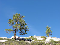
If you want to see Half Dome from the north side of Yosemite Valley, with a view up close and almost directly head-on, then a hike out to North Dome is for you. The trail head is about 1.2 miles past the turnoff for Porcupine Creek parking area going west on the Tioga Road. The scenery on this road is beautiful and more unique than the other roads we have been on so far in the park. This roads winds through mountains that are literally solid granite with a few trees growing out of the cracks. This is probably attributed to the fact that the elevation is over 8000 feet most of the way, so you are at the top of the surrounding mountains. Once on the trail, you walk down the bank where the trail is an old paved road for 1 to1.5 miles. This part of the trail is very forested with many large felled decaying trees. You can see everywhere that bears and/or other animals have torn the logs apart looking for insects. Once the paved road section ended, the trail continued on a dirt path through more forest with very little elevation gain/loss. This section of the trail continued for about 2 miles going up and down various hills and small valleys until you come to the junction of Indian Rock trail. This is where the forest starts to open and you can begin to see views of the south ridge of the Valley. For a quick side trip, the Indian Rock trail is a 0.3 mile trail that takes you to a rock spire with an arch on top. From on top of this rock, there are views of Half Dome just over the trees. Continuing towards North Dome, the trail veers to the left of a small granite dome. Within a half of a mile, the trail takes you into the open, where you are on top of the first of two large domes. The second one is North Dome and is actually below the current vantage point. To the left is Half Dome - with a face view. From this position you really get a perspective on the magnitude of this mountain. You can also see the many waterfall chutes around this mountain. Most of the famous photos of Half Dome are from the side, so you don't realize how large it is compared to the surrounding peaks until you see if from North Dome. An interesting American Indian folklore tells a story of a woman and her husband who argued and fought. This displeased the spirits who changed them into stone, Half Dome and North Dome, forever to face each other across the Yosemite Valley (which is probably better than the 28 feet of living space that we share - especially after an argument). Continuing on the hike, you work your way down to the second dome; the trail here at times takes you through steep cracks in the granite dome and through narrow switchbacks. Once down and at the base of North Dome the hiking is easier and is over fields of granite. From the top of North Dome you can see Yosemite Valley and Glacier Point to the southeast. There are also many views of the surrounding Sierra mountains. The total trip was over 10 miles and took us about 5 hours to complete. We would rate this hike as moderate in some places and strenuous in other places, but unique and we'd recommend this hike for those who would like to see this perspective of Yosemite Valley and Half Dome.


No comments:
Post a Comment