
 |
| Whitewater River basin |
The hiking club was back at it again. This time we hiked the Canyon Ridge Trail in the Whitewater Preserve. This is a loop trail that offers inspiring views looking down on the Whitewater River basin as well as views of Mount San Jacinto, various San Gorgonio mountains and the surrounding hills. This was a nice time to take this hike because the temperatures were cool and there was snow on the tops of the distant mountain. Seeing the snow provided an interesting contrast to the desert terrain for which we were hiking. Another great time to take this hike would be in March and April when the plants are blooming and mountains are their most green.
You can start this hike in two different places; at the ranger station or a half mile before at the bridge that crosses the Whitewater River. If you start at the ranger station, the trail winds through the flat river basin for a quarter of a mile before starting up steep switchbacks. This would give you time to warm up. Starting at the bridge, you begin the hike with many steep switchbacks until you reach the actual canyon ridge which is about a half of mile. The group went for it and started at the bridge.
 |
| Trail on top of the ridge |
Once on the ridge the trail levels off and provides great vistas of the terrain. We often stopped and scanned the hills across the canyon for Bighorn sheep (we were told that’s where they like to hang out) but despite our tries we had no luck. In two miles or so the trails comes to a “T”; going right continues the ridge loop and heading left (west) takes you to Saddle Mountain. The group decided to hike toward Saddle Mount for two mile then headed back to this “T”. This segment offered views of other smaller canyons and of Mt San Jacinto. It is a nice addition if you want to add a little more hiking to your day. From the “T”, we headed down into Whitewater Canyon via some steep switchbacks (around one mile). At the bottom, the trail intersects with the Pacific Crest Trail (PCT). Go left and you can continue on the PCT or right for half of a mile through the actual river basin to the Ranger Station.
 You do have to cross small channels of the river so make sure it’s passable before starting this hike. From the Ranger Station we walked a half mile on the road back to our cars that were parked near the bridge.
The Wildlands Conservancy purchased this land to protect natural wildlife corridors between the San Bernardino and San Jacinto Mountains by restoring the land back to its natural state. This includes retiring grazing cattle which has helped restore Whitewater River quality, removal of a housing subdivision deep in the canyon and eliminating non-native plants. This canyon and surrounding area supports bighorn sheep, deer, bear and more.
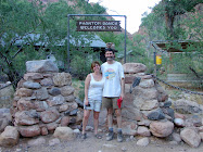
The once privately owned trout farm has been transformed into the Ranger Station and visitor facility featuring picnic areas near the trout ponds (with actual fish) and information about the surrounding area and hiking. Enjoy!!
Directions:
From the Cochella Valley take I-10 west. Go past the exit for Hwy 62 and take the next exit which is Whitewater. At the stop sign turn right and then take a left on Whitewater Canyon Rd. Continue on this road for 4-5 miles until you reach the concrete bridge going over the river. You can park along the road here or continue a half mile and park in the Ranger Station parking lot.


No comments:
Post a Comment